Products and services
What Merra offers
Sensors, apps, models and data services that turn marine data into decision support. Select a product for a short description of what it is and how it is used.
Products
- Merra-trackInshore vessel tracking with proven trackers.In use
- Merra-catchA phone app for recording catch at sea, haul by haul.Beta
- Merra-scanA 3D scanner that identifies and measures crabs, lobsters and scallops.Field trials
- Merra-camA privacy-first camera that counts creels as they come aboard.Field testing
- Merra-log and Merra-routerA low-cost environmental logger, with a router that sends its data ashore.Pilot · available summer 2027
- Merra Mussel SamplerA phone app for mussel rope samples and dropper surveys.Pilot
- Merra-hubThe secure data hub behind every Merra product.In use
- Merra-portalWhere track and catch data become decision support.In use: pilot scale
- Merra Stock DeskOpen-source stock assessment for crab and lobster.Open source
- Merra-shellfishGrowth and harvest forecasts for mussel farms and co-operatives.Available for farm trials and validation
- Merra Fish FarmA working model of a salmon farm.Pilot
- Merra-driftOnline drift modelling for oil spills, jellyfish, sea lice and more.Available
- Merra-tagAnimal-borne sensor tags, designed with simulation.Field testing
- Merra-seatrialA vessel simulator for testing and training.In development
- Merra-strandA field app for recording marine animal strandings.Beta
Services
- Research, development and servicesMonitoring programmes, bespoke development, modelling and data analysis, as a contractor, partner or subcontractor.
Merra-track
In use
What it is. An inshore vessel monitoring system (iVMS) built on tried and tested trackers from the transport and logistics sector, with full remote configuration.
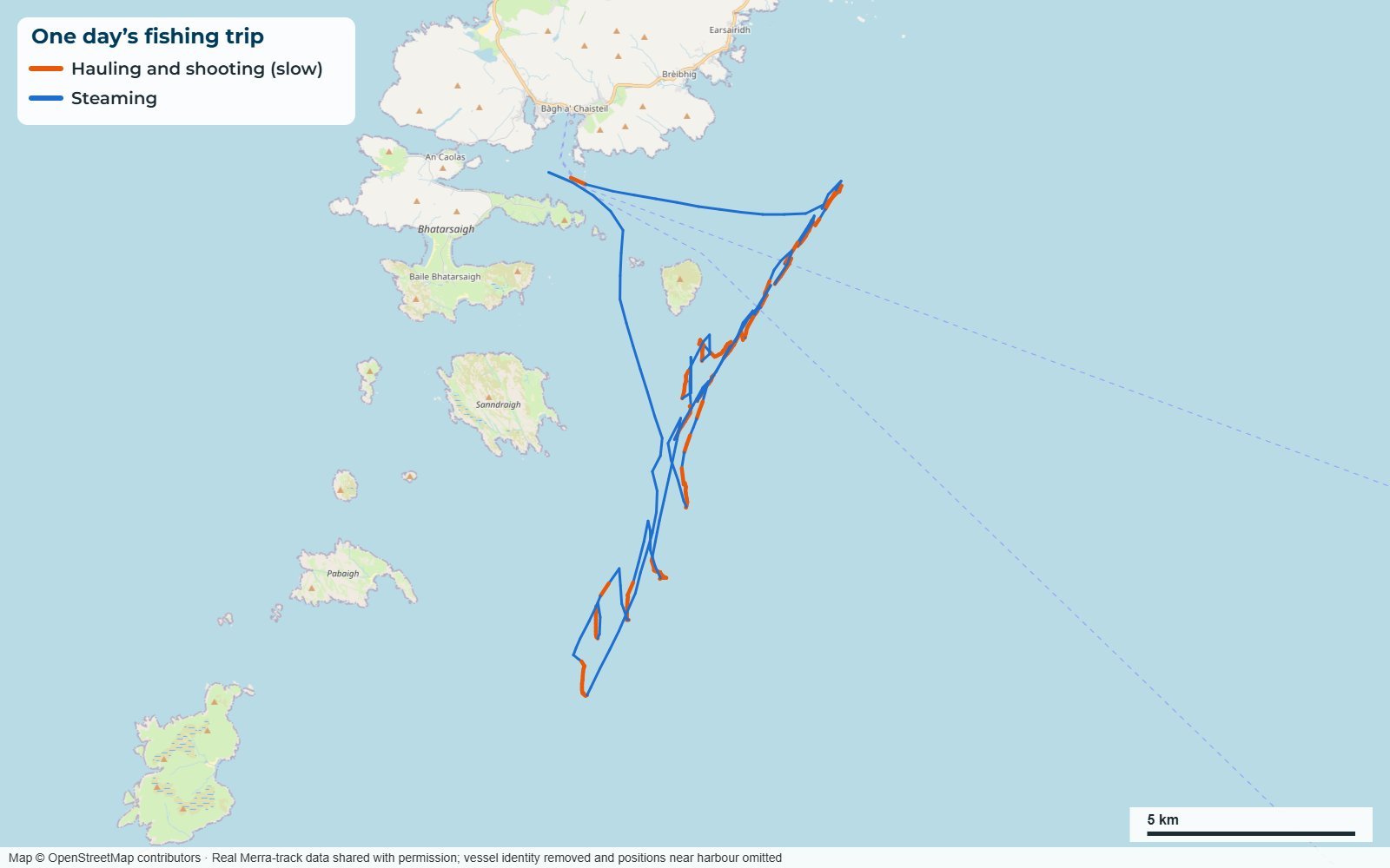
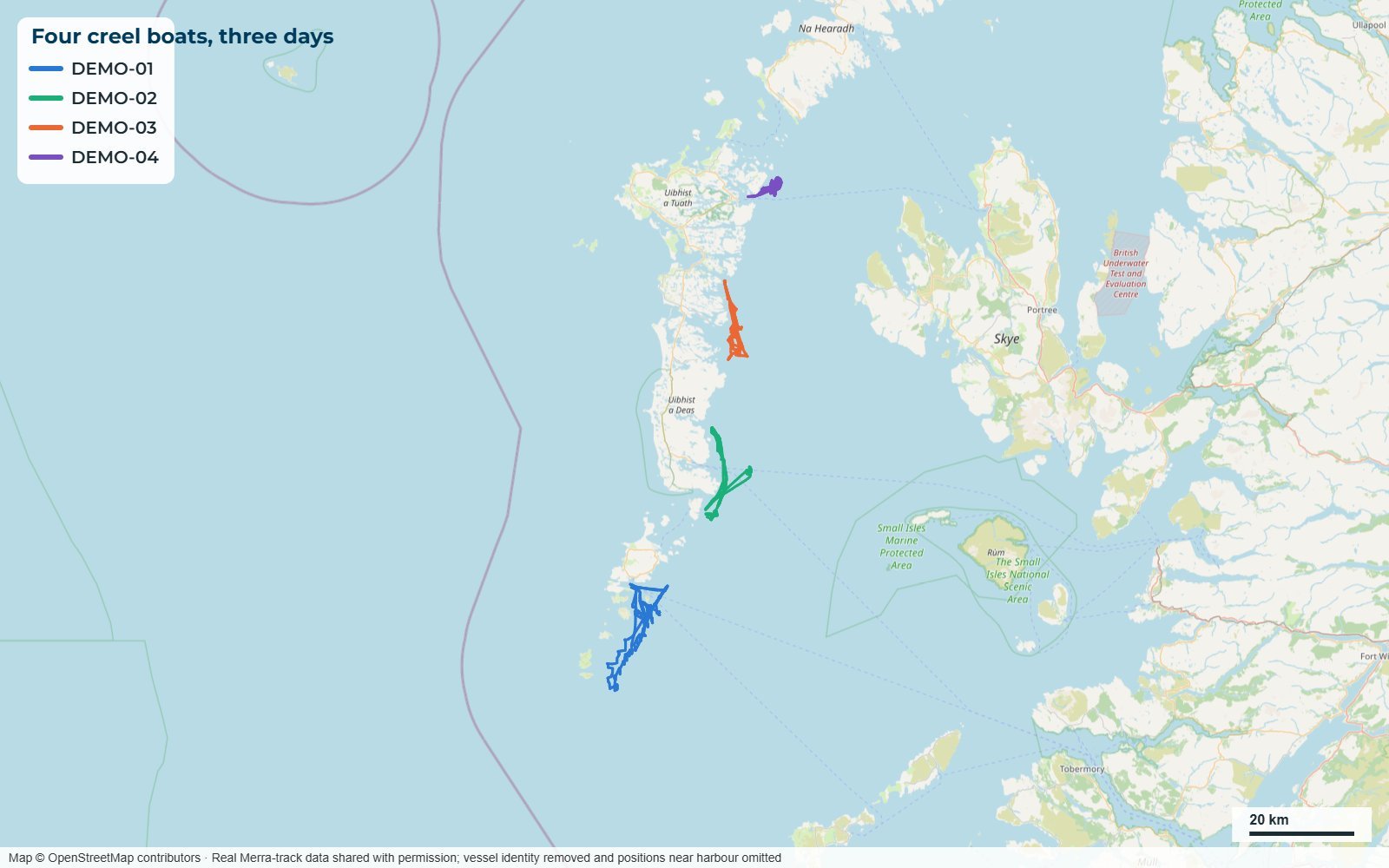
How it is used. The tracker is fitted to a fishing vessel and sends its positions over the mobile network to Merra-hub. There the track is analysed to show where and when the vessel was fishing, steaming, hauling and shooting, and how long gear was left to soak.
Merra-catch
Beta
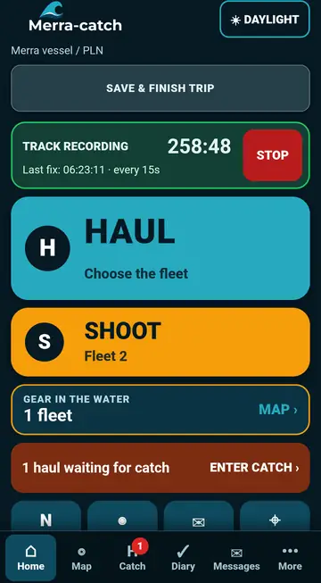
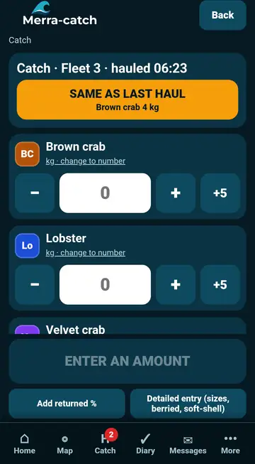
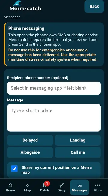
What it is. A mobile app for fishers to record hauling, shooting and catch. It works offline at sea, has large, easy-to-use buttons and can be operated by voice on Android.
How it is used. The skipper logs each haul as it comes aboard. Records are linked to the vessel’s track in Merra-hub to give detailed catch and effort, which the fisher can see in Merra-portal, and they can support statutory reporting where required.
Merra-scan
Field trials
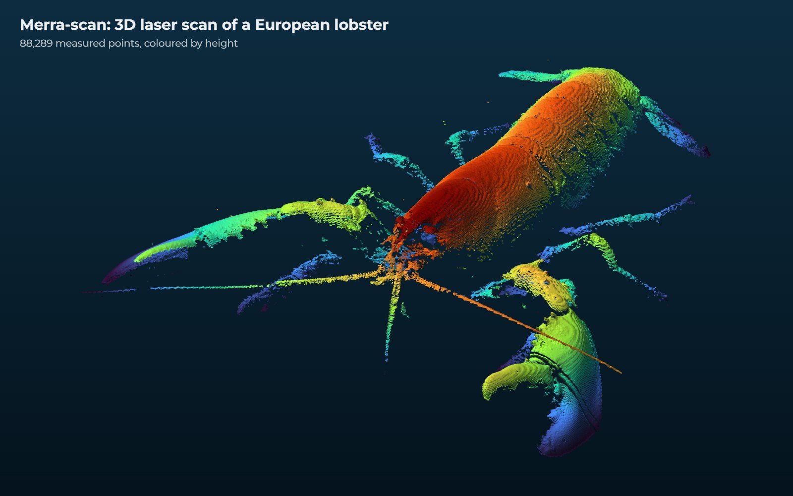
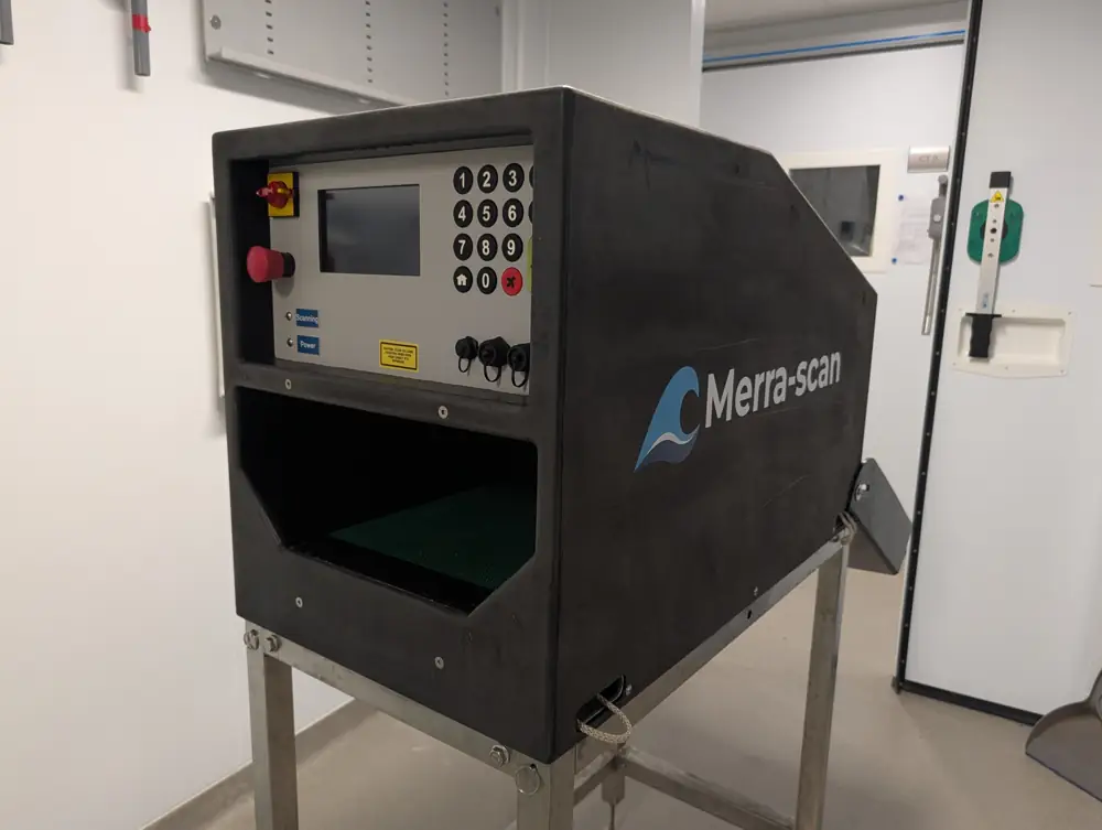
What it is. A portable 3D laser scanner for use on the deck of a fishing vessel or in a processing factory. So far it has been trained on brown crab, European lobster and king scallop.
How it is used. Animals pass through the scanner one at a time on a conveyor. AI predicts the species, sex, size and weight of each one, and the results are sent with time and position to Merra-hub, where they can feed stock assessments such as Merra Stock Desk.
Merra-cam
Field testing
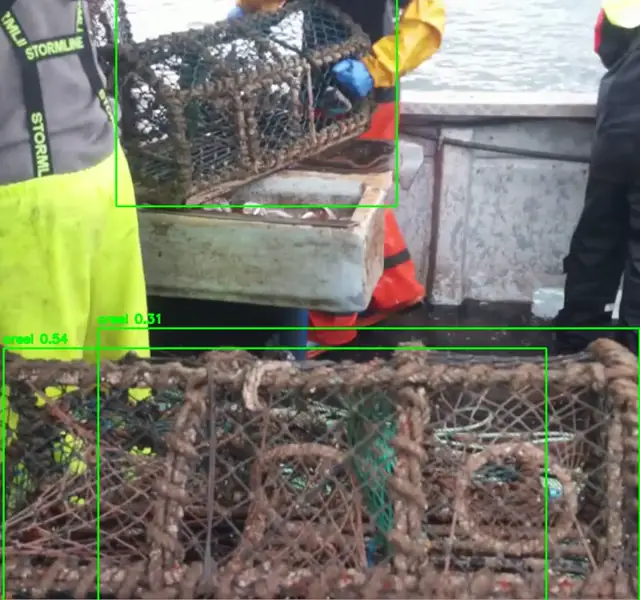
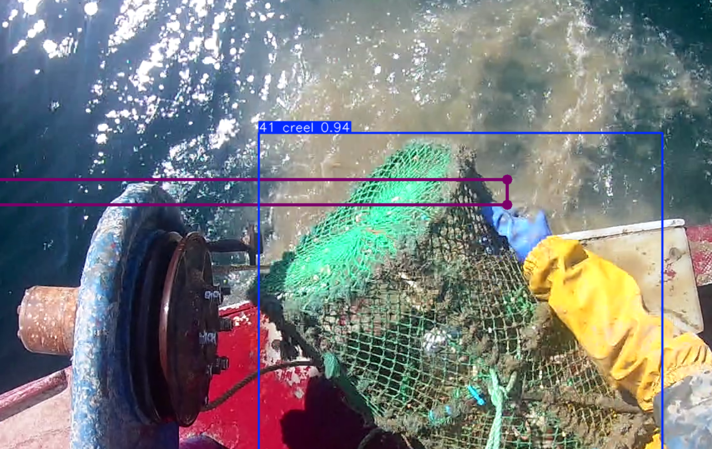
What it is. An AI camera system that counts objects, such as creels, on working fishing vessels. Everything is processed on the device: no images are stored or transmitted.
How it is used. Mounted on a vessel, it counts creels as they are hauled and keeps only anonymised counts with time and position. The counts give a direct measure of gear in use and help check estimates made from vessel tracks.
Merra-log and Merra-router
Pilot · available summer 2027
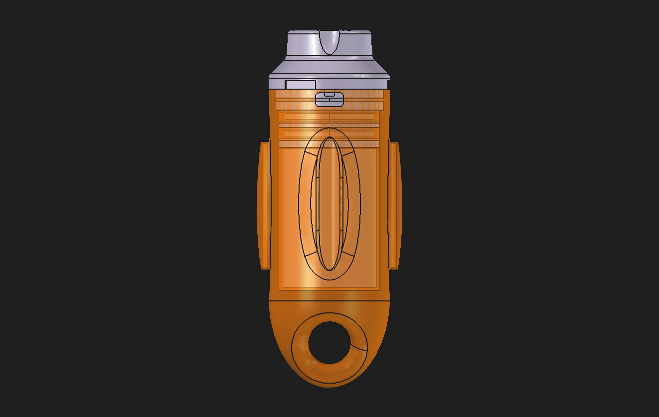
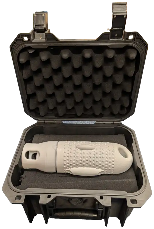
What it is. A multi-sensor logger that records temperature, depth, conductivity, light and movement, and Merra-router, a small communications hub that relays the logger’s data to Merra-hub.
How it is used. The logger is attached to existing equipment such as creels or shellfish farm lines. When it comes to the surface it passes its stored data to Merra-router on the vessel, which sends it over the mobile network, so environmental data arrive without extra trips to collect them.
Merra Mussel Sampler
Pilot
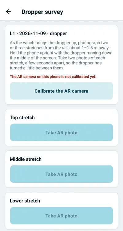
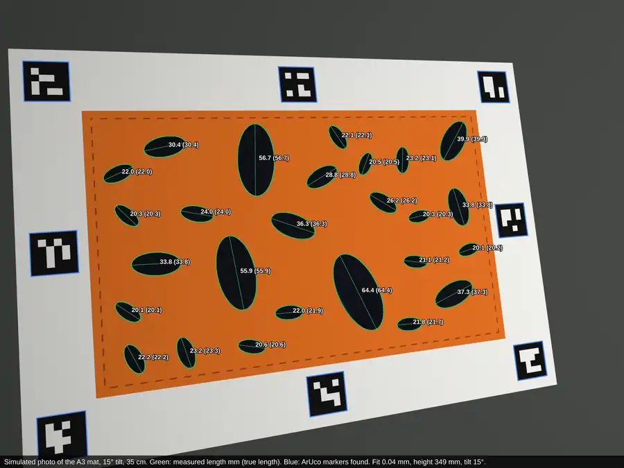
What it is. A phone app, developed as part of the field validation of Merra-shellfish, for recording mussel lines and taking calibrated photographs of droppers and samples.
How it is used. Farm staff tip a sample onto a printed calibration mat and take one photo; the app measures every shell. The records are sent to our server and used to calibrate the Merra-shellfish growth model for that farm.
Merra-hub
In use
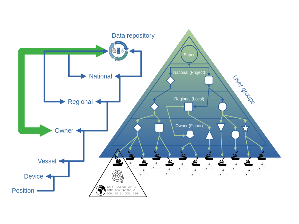
What it is. A secure database that receives data from Merra devices and apps over the mobile network, and stores, checks, cleans and analyses it automatically.
How it is used. It works in the background. As well as Merra-track it can accept data from over 140 other types of tracker, so existing equipment can join the system. Fishers stay in control of their data, and each user sees only what their role allows.
Merra-portal
In use: pilot scale
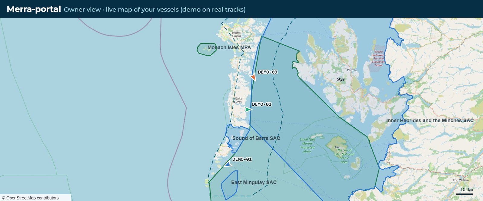
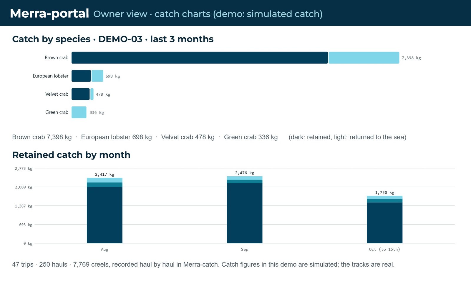
What it is. A web portal that presents the analysed track and catch data held in Merra-hub.
How it is used. Fishers see their own vessels, trips, fishing activity and catch. By agreement with the fisher, a specified part of their data, for example positions inside a management area, can be shared with government or regulators. Nothing else is shared.
Merra Stock Desk
Open source
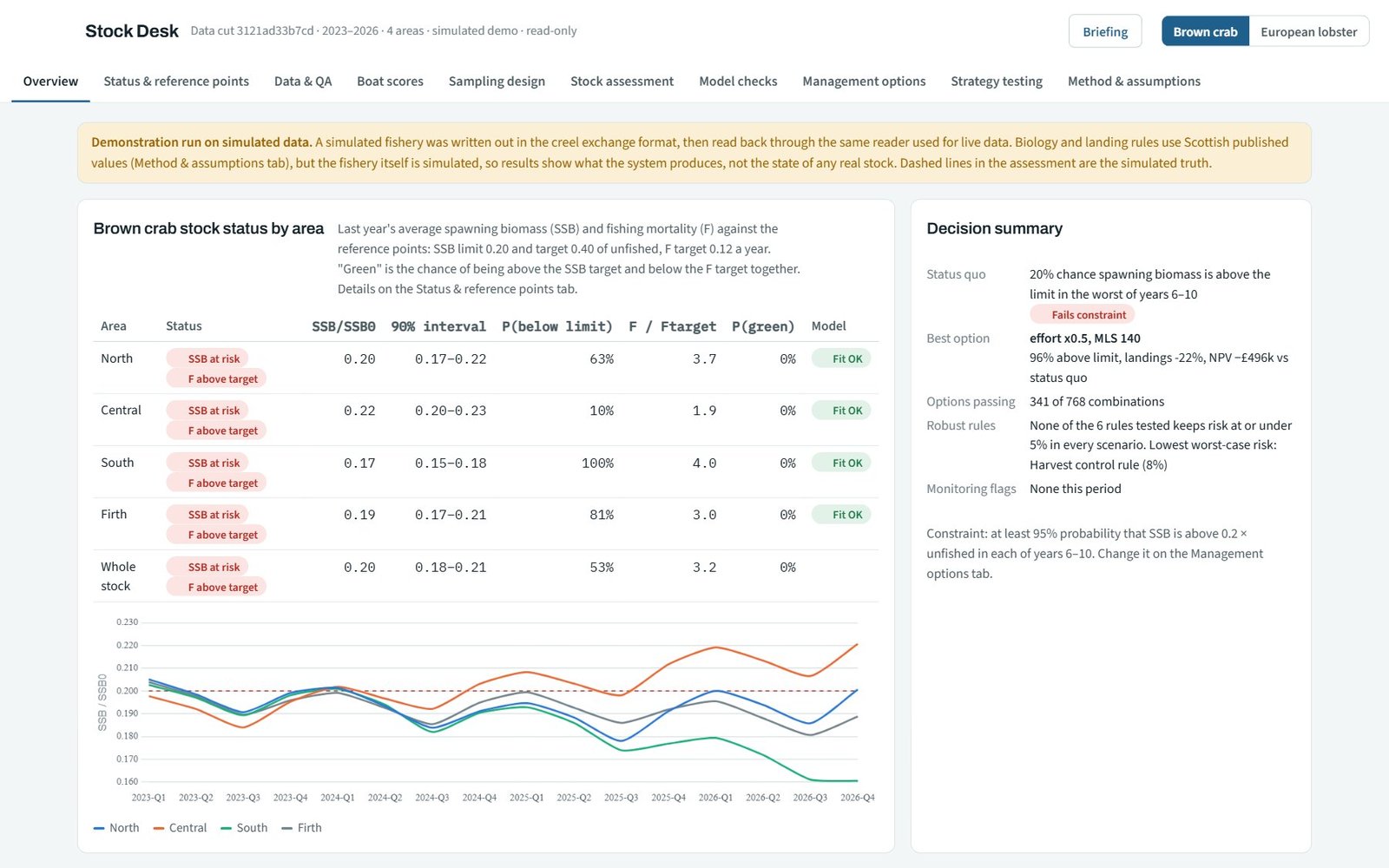
What it is. An open-source suite for assessing brown crab and European lobster stocks from data collected by fishers.
How it is used. Measurements from fishers, such as those from Merra-scan, feed length-based assessments. Results come with a plain-language briefing for fishers and policy makers.
Merra-shellfish
Available for farm trials and validation
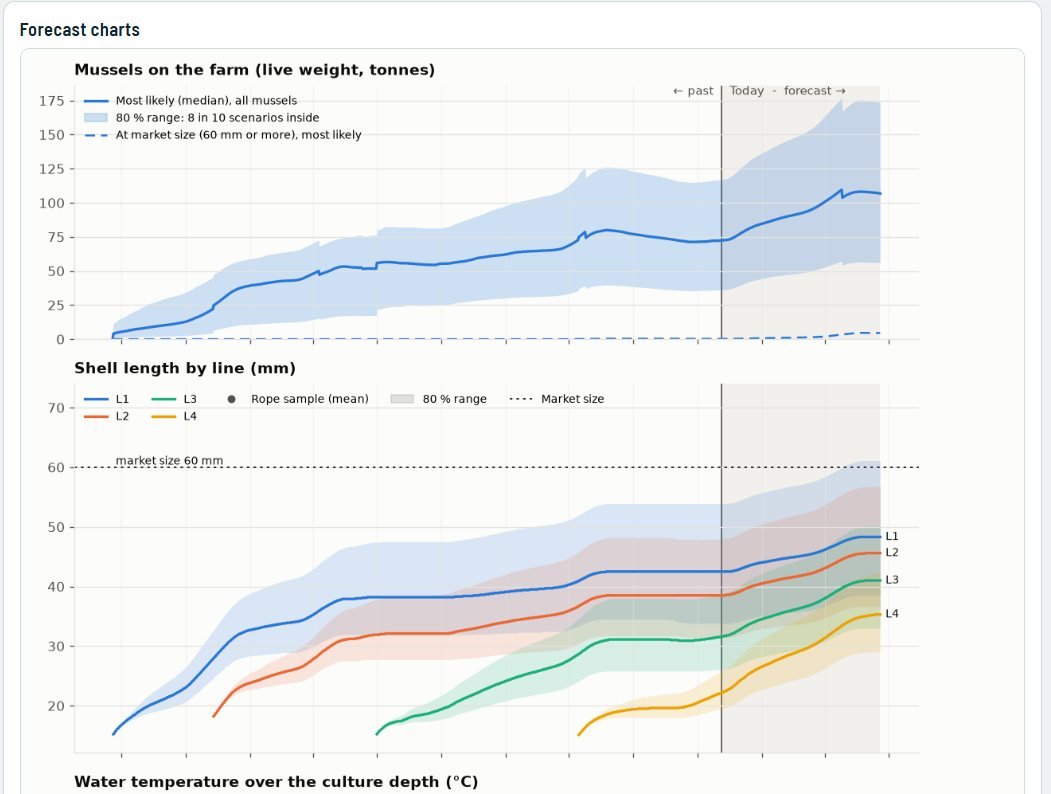
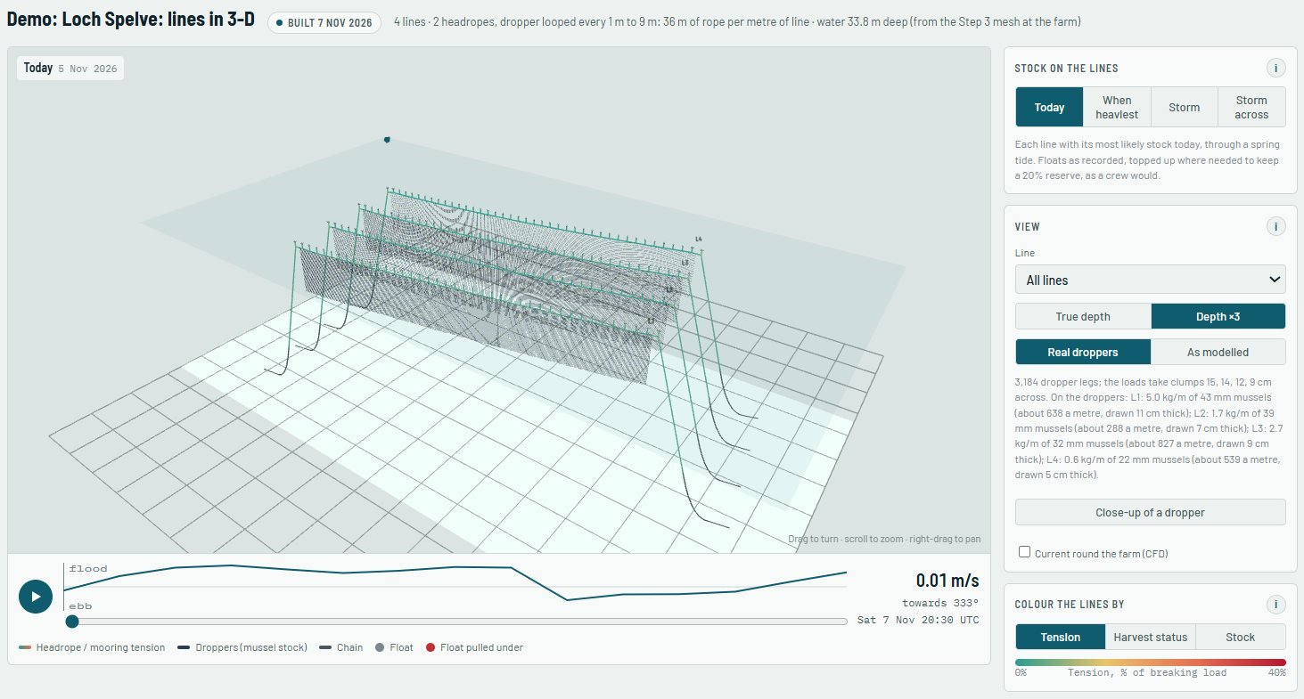
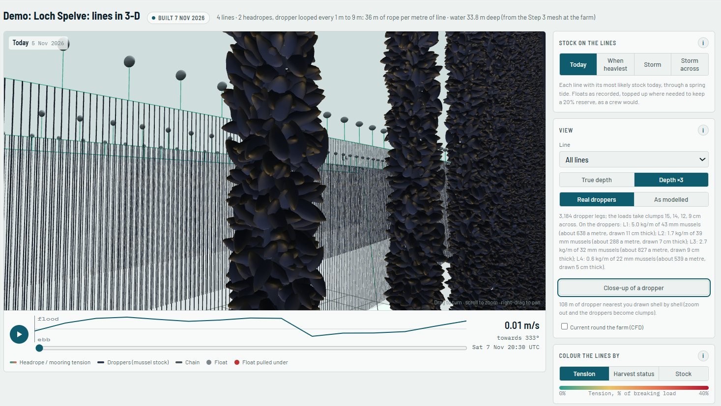
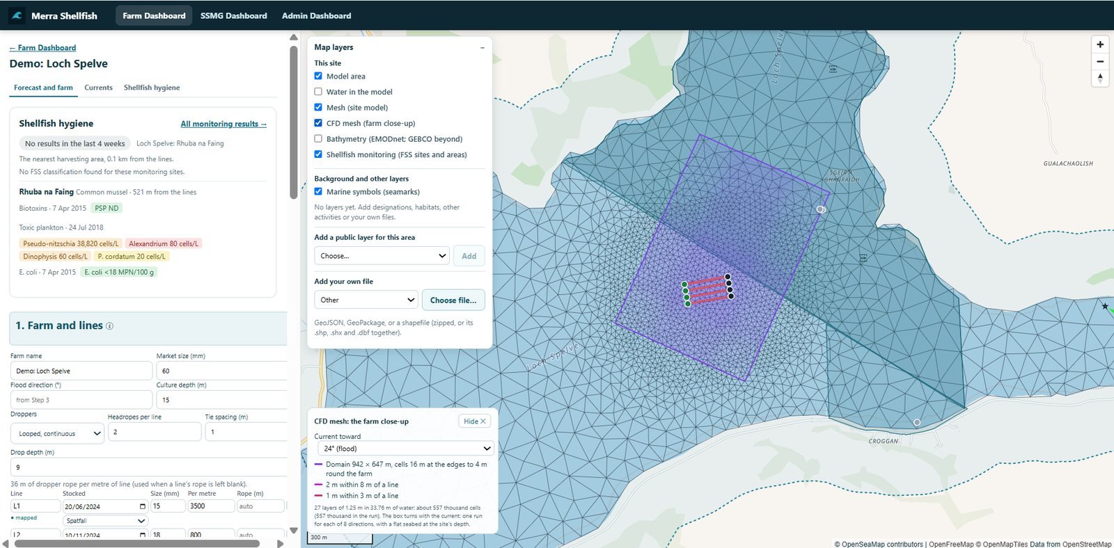
What it is. A forecasting system for mussel farms that combines ocean models, weather, satellite observations and official monitoring with data from the farms themselves.
How it is used. Farmers set up their own sites and lines. Merra-shellfish models the currents and mussel growth and forecasts harvests, showing a range rather than a single number. A co-operative can see across its member farms to plan harvests, processing and sales.
Merra Fish Farm
Pilot
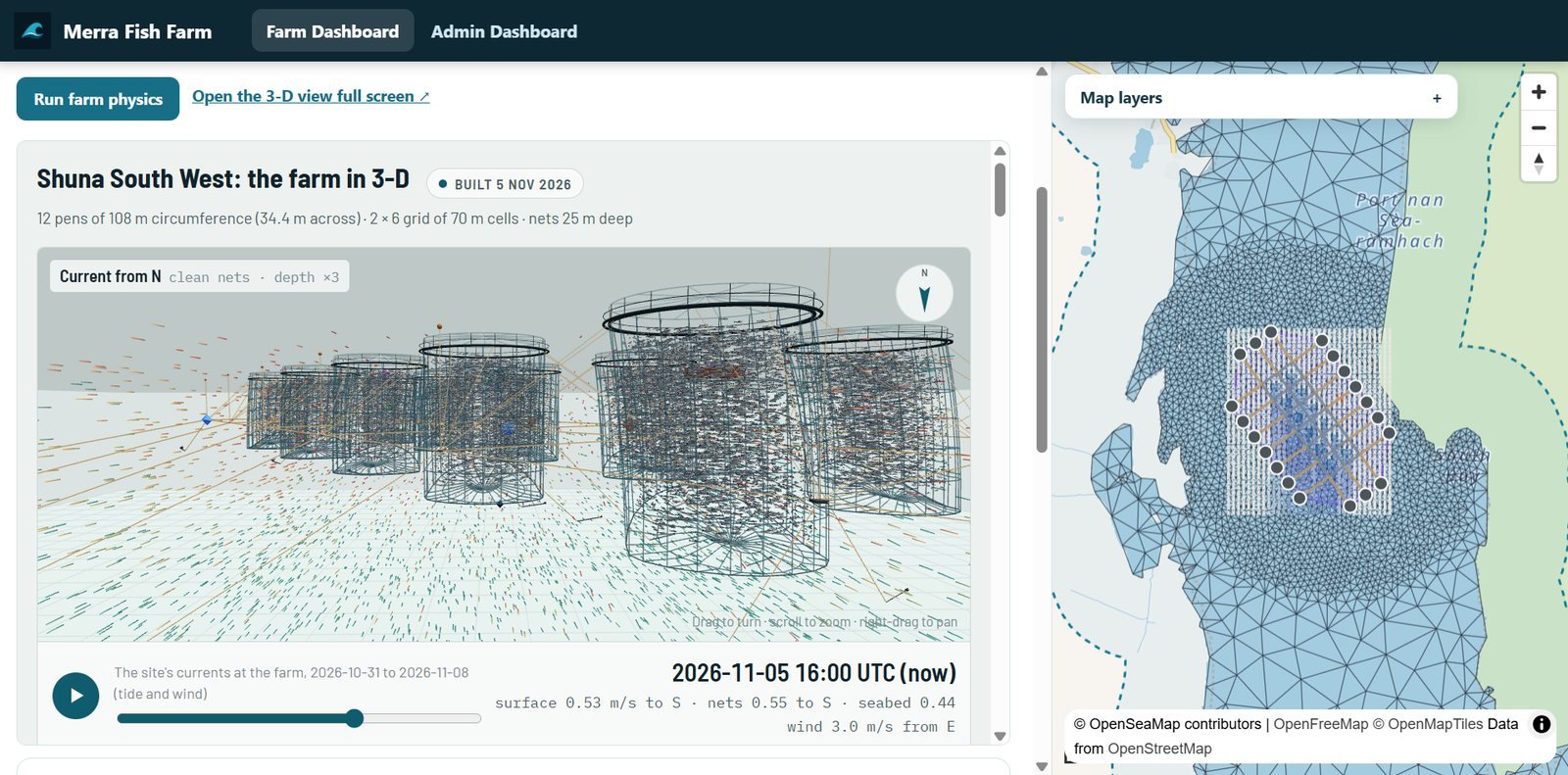
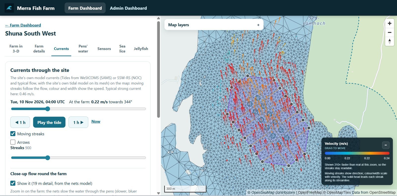
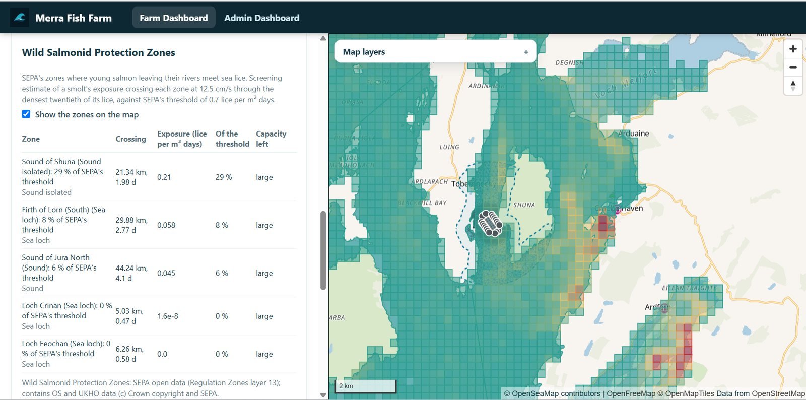
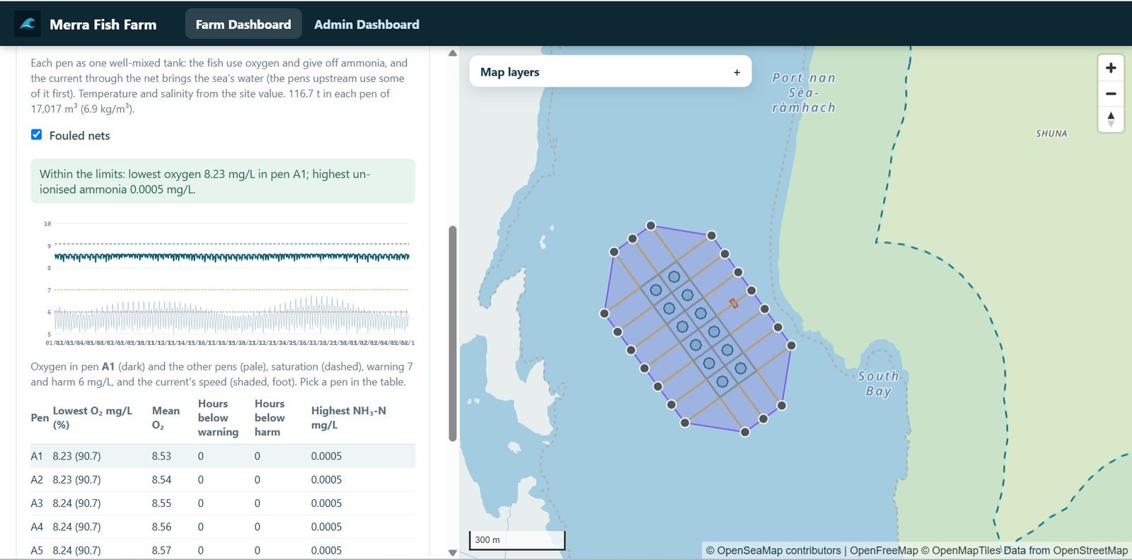
What it is. A model of a salmon farm’s pens, nets and moorings in 3D, with the currents through the site and the oxygen in each pen.
How it is used. Farm staff can see, without specialist help, how currents move through and around the farm as the tide turns, and where sensors would tell them most.
Merra-drift
Available
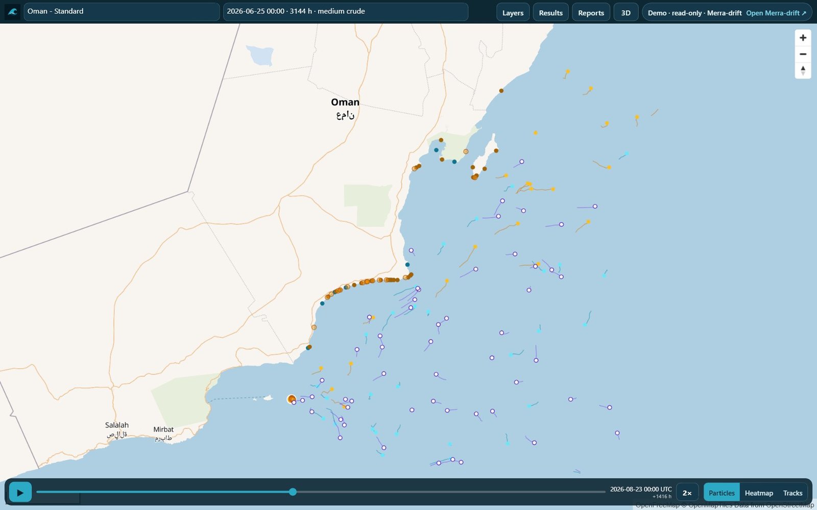
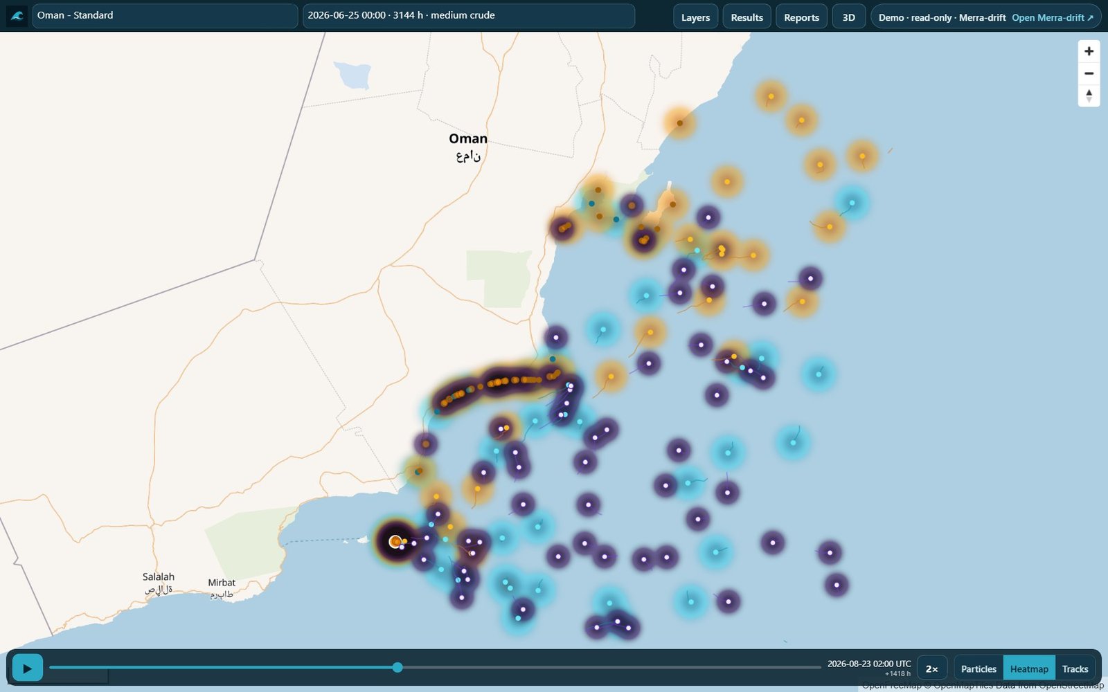
What it is. An online drift modelling platform for oil spills, jellyfish blooms, sea lice, search and rescue and similar questions. It is built on OpenDrift, the open-source framework from the Norwegian Meteorological Institute.
How it is used. The user sets up an area; Merra-drift brings in current, wind and wave data, runs ready-made scenarios and produces situation reports. Oil spill predictions can be checked against Sentinel-1 and Sentinel-2 satellite images.
Merra-tag
Field testing
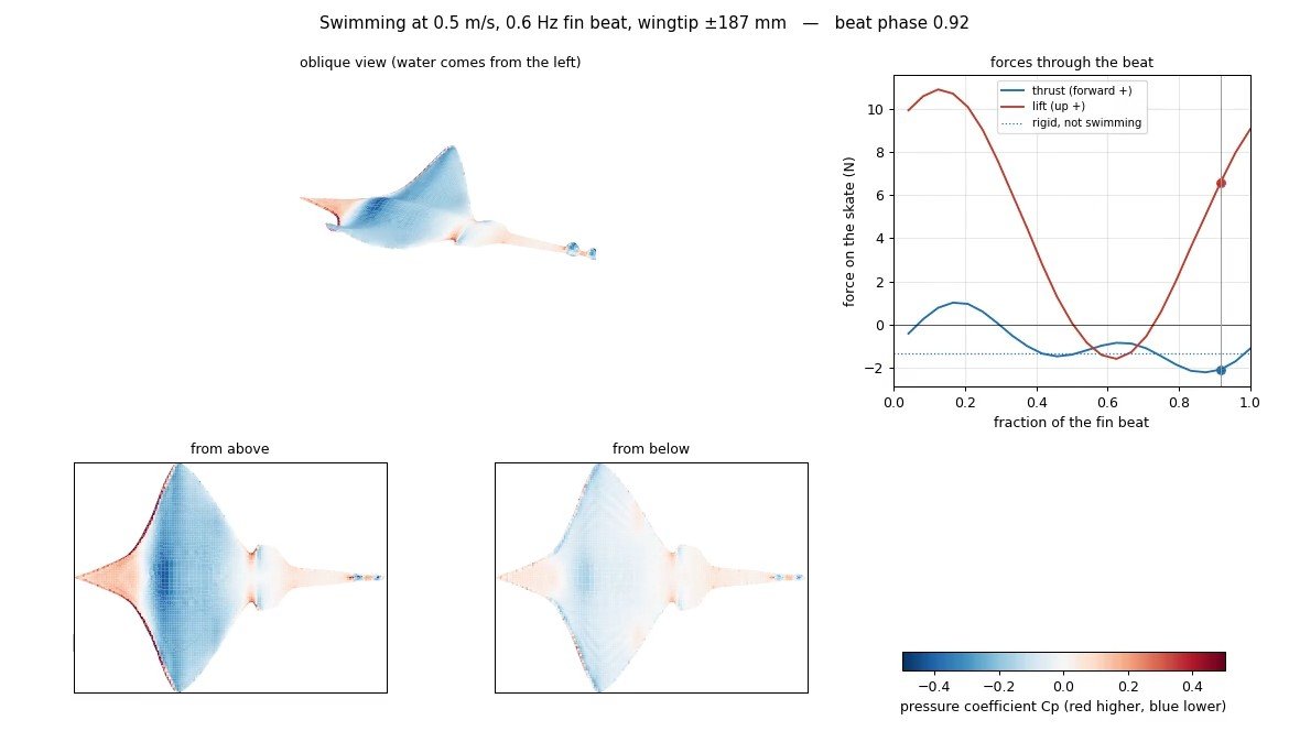
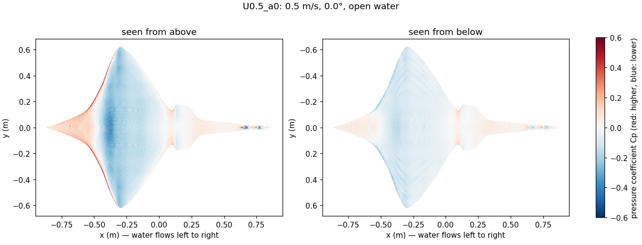
What it is. Sensor tags that collect environmental and movement data from the animals that carry them, starting with the critically endangered flapper skate.
How it is used. Before tags are deployed, computational fluid dynamics on a scanned 3D body shows how a tag’s shape and position change the drag on the animal. The tag records are then used to understand how the animal moves and the conditions it experiences.
Merra-seatrial
In development
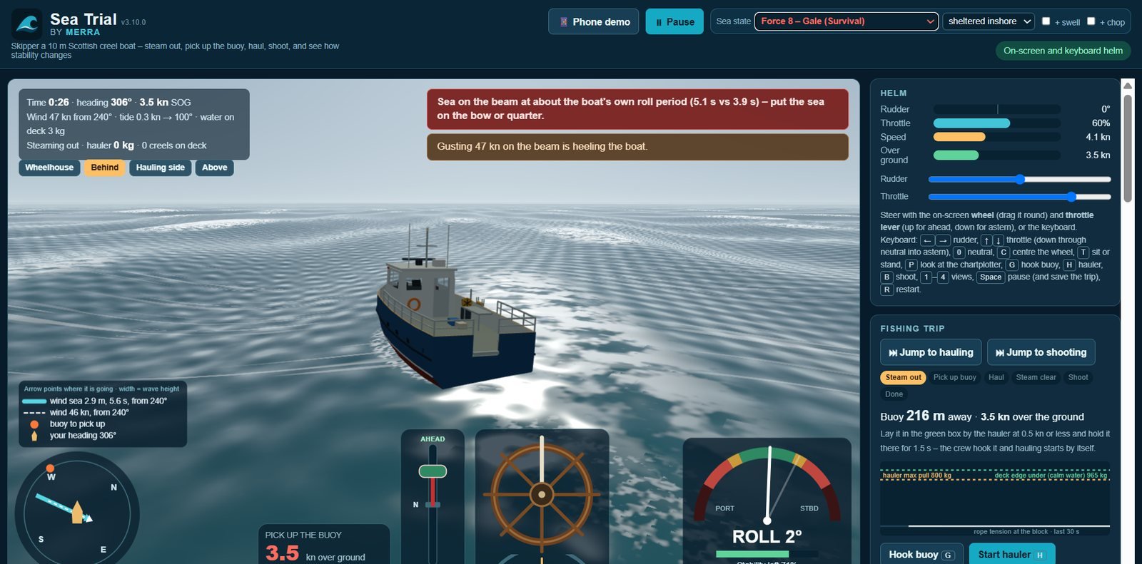
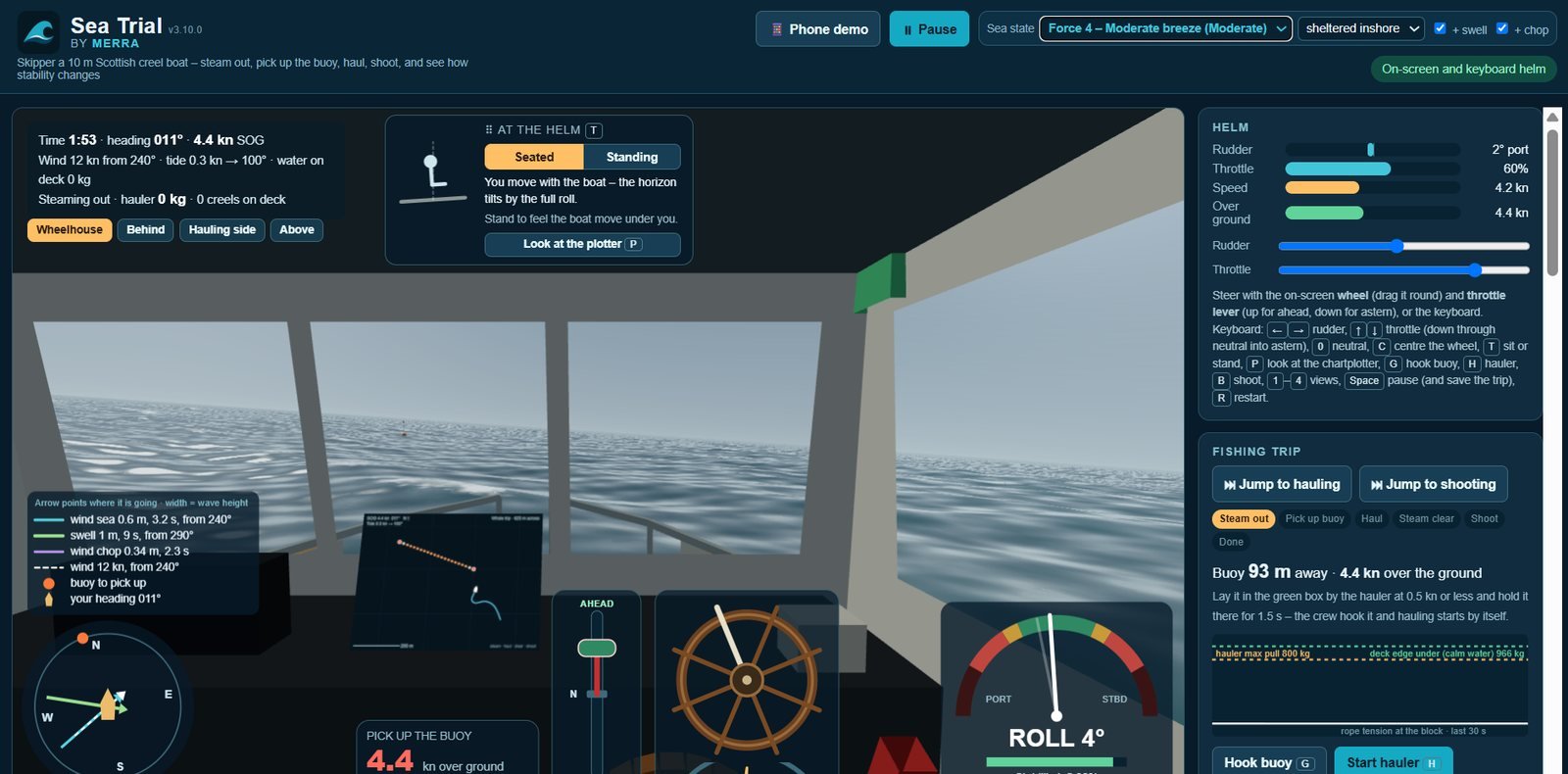
What it is. A simulator that uses real vessel designs and performance in wind and waves that the user controls.
How it is used. It shows how a vessel moves in different conditions and how its stability changes with the load on board, such as creels, catch and water in live-catch tanks. Motion recorded at sea with our own sensors is used to test it.
Merra-strand
Beta
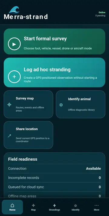
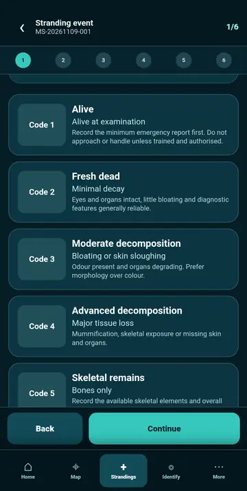
What it is. A mobile app that guides non-specialists through recording marine animals found stranded on the shore, following accepted best practice.
How it is used. Volunteers, rangers and researchers record each stranding in the same structured way, so their records can be used together.
How to get it
To discuss any Merra product or service, contact info@merra.org.